
For any green space which we want to be designated we have to provide an assessment, which follows a standard form. This has been started but there is a lot more work to be done. If anyone would like to help with this please let us know. For more information click here.
A total of 27 green spaces have been identified within the neighbourhood area and assessments of each of them have been or are in the process of being carried out. If you can help with this or notice any errors please let us know by email at
The sites are shown on this map:
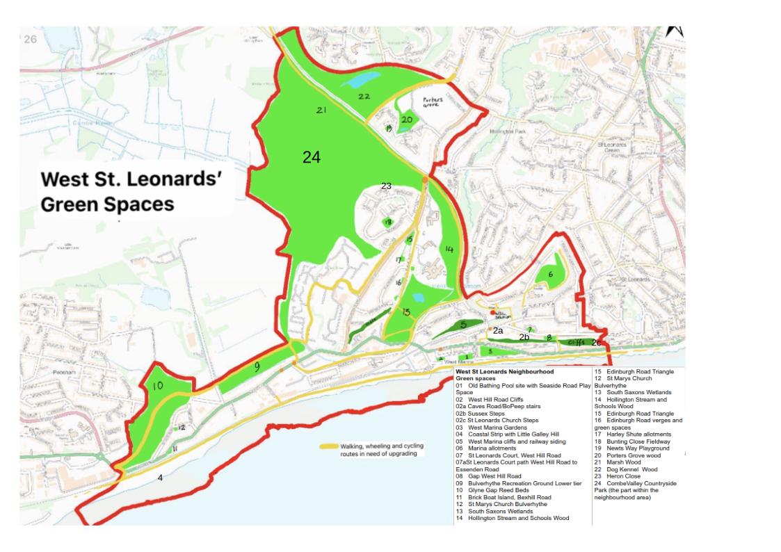
click here to get the map in pdf format
And they are as follows and clicking on each item will take you to the specific file. The files can be downloaded and the 5 which are incomplete have the word incomplete in their file name, this is also noted in the comments column.
|
No on map |
Name |
Comments |
|
01 |
Old Bathing Pool site with Seaside Road Play Space and car park |
|
|
02 |
West Hill Road Cliffs |
Incomplete |
|
03 |
||
|
04 |
Incomplete |
|
|
05 |
||
|
06 |
||
|
07 |
||
|
07a |
||
|
08 |
||
|
09 |
||
|
10 |
||
|
11 |
||
|
12 |
||
|
13 |
||
|
14 |
Incomplete |
|
|
15 |
||
|
16 |
||
|
17 |
||
|
18 |
||
|
19 |
||
|
20 |
||
|
21 |
Marsh Wood | |
|
22 |
||
|
23 |
||
|
24 |
Combe Valley Countryside Park (the part within the neighbourhood area) |
incomplete |